


 Biodiversity
 Brain
Brain
 Genetics
 Marine BiOLogy
 MicrobiOLogy
 PaleontOLogy
 ZoOLogy
 AnthropOLogy
 ArchaeOLogy
 Astronomy
 Climate Change
 Earth
Earth
 Physics
 Water
Water

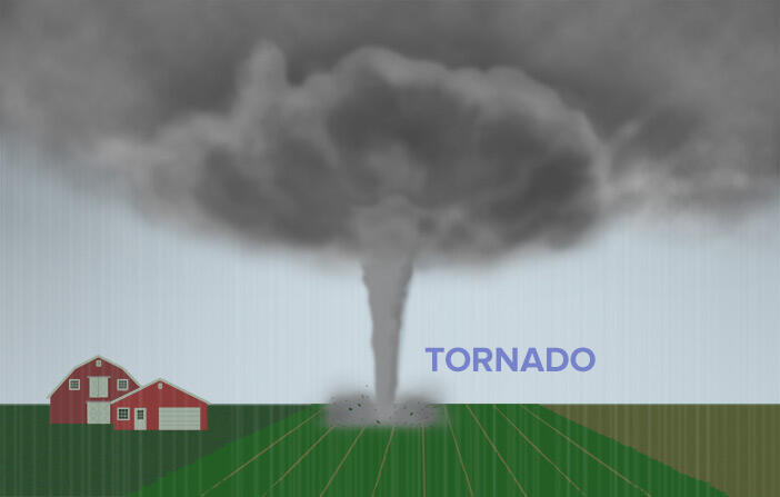
TORNADOES
SPINNING THUNDERSTORMS
With its swirling column of wind, a tornado is one of nature’s most destructive storms. The most powerful tornadoes can rip houses from the ground, throw cars in the air, flip trains, and topple trees.
What causes tornadoes? How do scientists study them?
Let’s find out.
A Tornado is Coming!

On a spring night in 2007, disaster struck Greensburg, a small town in Kansas. Shortly before 10 p.m., a warning was issued that a mile-wide tornado was approaching. And it wasn’t just any tornado. With winds estimated to be more than 320 kilometers (200 miles) per hour, it was a category EF5, the most powerful there is.
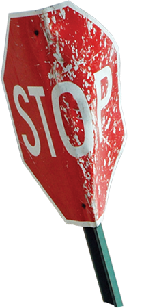
A tornado’s powerful winds can bend a stop sign.
The warning sirens gave most people the time they needed to escape to their basements and storm shelters. But few structures can withstand an EF5 tornado. In less than ten minutes, the storm ripped the town to shreds. Once the fury had passed, people climbed through the rubble. They found their homes crushed, or simply torn away. Ten lives were lost, and 95% of the town’s structures were damaged or destroyed.
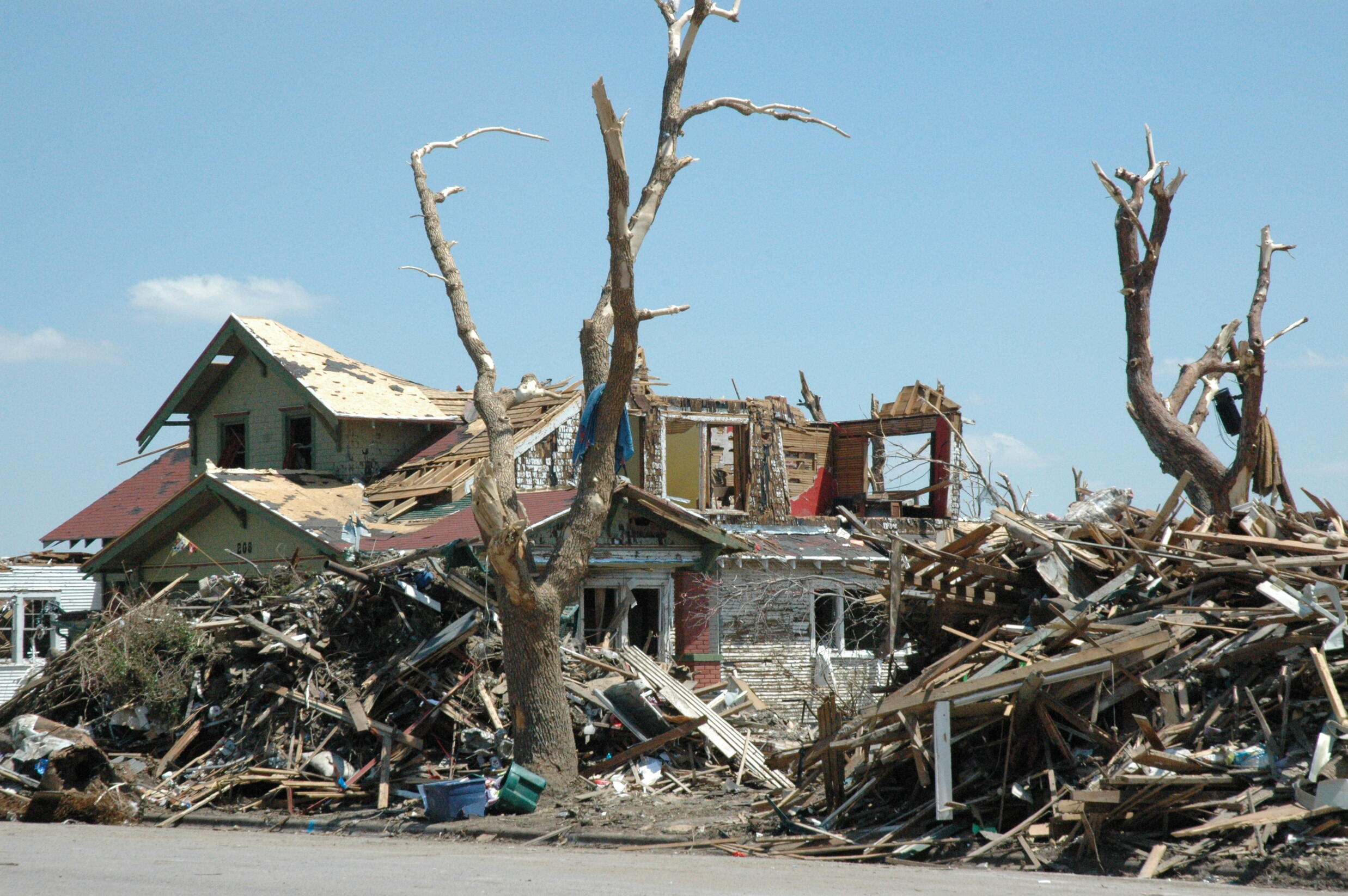
The tornado destroyed much of the town. Many people had to find other places to live until their homes were rebuilt.
“I’m in downtown Greensburg. There’s really nothing left.”
How does a tornado form?
All tornadoes start from thunderstorms. But not all thunderstorms produce tornadoes. It takes just the right conditions for a tornado to form.

More than 75% of all tornadoes in the world take place in “Tornado Alley,” an area that spans eight states in the Central U.S. This region has just the right conditions for thunderstorms to form: cool, dry air from the Arctic mixing with warm, humid air from the Gulf of Mexico, combined with warm, dry air from the southwest.
Explore how a tornado forms.

Thunderstorms form when warm, wet air rises and mixes with cool, dry air above.
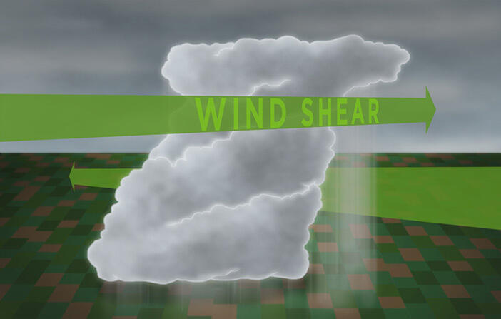
Some storms get stronger because of wind shear, when winds at higher altitudes move faster and in a different direction than winds at lower altitudes. Wind shear makes the storm tilt and rotate.

If a storm is strong enough, more warm air gets swept up into the storm cloud. At the same time, falling cool air produces a small cloud called a wall cloud.
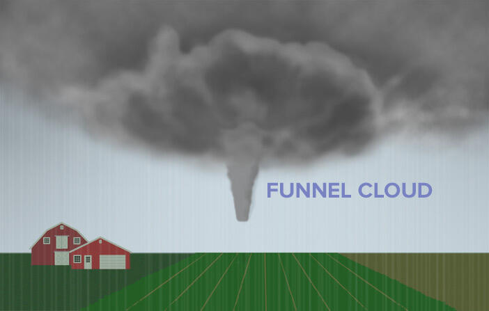
Inside the wall cloud, a funnel cloud forms and extends towards the ground. It causes air on the ground to rotate, and begin to rip up the earth.
When the funnel cloud meets the churning air near the ground, it becomes a tornado. When the updrafts lose energy, the tornado does too, and it slowly disappears.
How do scientists forecast tornadoes?
Meteorologists use radar to track severe storms like tornadoes. Radar works by detecting precipitation in a storm. The radar unit sends out radio waves that bounce off the raindrops, hail, or snow. The amount of time it takes for the wave to return tells meteorologists how far away the storm is. Radar provides detailed, up-to-the-minute information about the storm’s path. And when scientists see that winds are blowing raindrops in a circular pattern, they know a tornado might be forming.
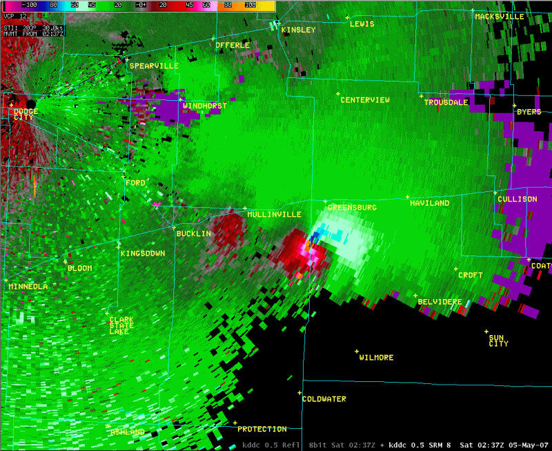
This Doppler radar map shows the area around Greensburg right before the tornado stuck. See the red and pink areas? They indicate higher precipitation than the green areas. The map also shows rotation and changing wind directions within a small area. Based on this data, meteorologists were able to identify the tornado.
A system of tornado watches and warnings is used to alert the public to danger. A tornado “watch” means thunderstorm conditions exist that could start a tornado. A “warning” means a tornado has already formed and been spotted. This system gives people in the storm’s path time to get to safety.
Preparing for a disaster
KNOW what types of disasters could happen in your community. Know the warning signals and evacuation plans.
PREPARE a disaster plan for your family that includes where to meet, who to call, and what to do with pets.
PRACTICE your plan to make sure everyone knows what to do.
KEEP a disaster supply kit on hand.
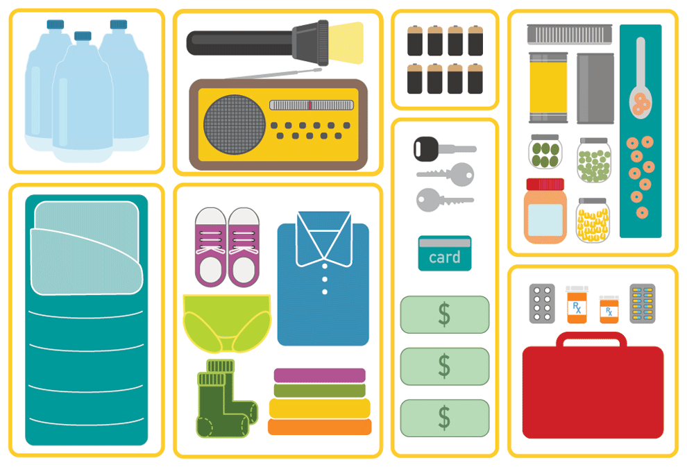
A disaster supply kit should include:
A three-day supply of water—one gallon per person, per day
Enough non-perishable food for three days
One change of clothing and shoes per person
Medications
Blankets and sleeping bags
A first-aid kit
Flashlight and extra batteries
Battery-powered radio
Extra set of car keys and a credit card or cash