Directions & Climate
Directions
From Interstate 10, exit at Road Forks, New Mexico (Exit No. 5 onto Hwy 80. Note that coming from Tucson you may be routed to Portal via a mostly unpaved route out of San Simon rather than driving on to the Road Forks exit in New Mexico. During wet weather, this route may have low water crossings that could be impassable. The paved highway described below is about 20 miles longer and takes about 10 more minutes but is recommended in adverse conditions.)
- Take Hwy 80 south approximately 30 miles to route 533 (if you reach Rodeo, New Mexico, you’ve gone too far and must backtrack 2 miles).
- Turn right (west) on route 533 and go approximately 7 miles to Portal, Arizona. You’ll know you’re in Portal when you see Portal Peak Lodge on your left.
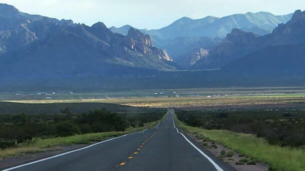
- Continue up the mountain, staying on pavement, another five miles (DO NOT take the right fork to Paradise). You’ll see an in-ground reservoir on your left, followed by an expanse of grass and a cluster of buildings.
- Immediately after those buildings, you will turn left and cross over a wash.
- Just after crossing the wash, make another left through the gates and onto our grounds.
- Park in the main parking lot and walk down the dirt road to the first two-story building on your right. The office is downstairs.
- If you get lost, please call us at 520-558-2396. Remember, there is no cell phone service near the SWRS. You can also stop at the Portal Peak Lodge and Store and ask for directions. They will be happy to guide you in the right direction to the station.
Maps
Environment and Climate
The Southwestern Research Station is located at around 5400 feet elevation in riparian habitat, surrounded by oak-juniper-pinyon pine woodlands. Within a short drive up or down the Chiricahua Mountains, which reach nearly 9800 feet elevation, five life-zones can be encountered: Lower Sonoran, Upper Sonoran, Transition, Canadian, and Hudsonian.
Bio-geographically, the Chiricahua Mountains are located at a crossroads between distinct desert and mountain biotas. At lower elevations, species are influenced by both the Sonoran Desert to the west and the Chihuahuan Desert to the south and east. At higher elevations, there is a mixing of plants and animals from the Rocky Mountains, to the north and the Sierra Madre Occidental Mountains of Mexico.
The uniqueness and diversity of the biota is well recognized by ornithologists, herpetologists, and entomologists. Cave Creek Canyon is also recognized as one of the top birding localities in the United States.