Conservation Biogeography
More than 150 years after the publication of Darwin’s The Origin of Species, there are still gaps in knowledge about the processes by which species arise and how different environmental factors and human activities, contribute to the patterns where species are found – their biogeography. An improved understanding of these processes is crucial in the face of ongoing and future climate and environmental changes that threaten global biodiversity. Biodiversity conservation has historically focused on protecting areas of high species richness, known as biodiversity hotspots. However, often there is a missing link between knowledge of evolutionary processes and conservation planning and spatial prioritization of conservation areas. How can we conserve not only species, but also the processes that generate and maintain continued evolution?
The CBC's Approach
The CBC asks: How can we – the global community as well as local stewards of biodiversity – conserve not just species and ecosystems, but also the links and contexts that generate and maintain them? The CBC seeks to address this challenge through improved scientific understanding of the evolutionary processes that generate diversification, and in particular how they are influenced by the environment. We also advance open source software tools and training materials to encourage best practices in spatial biogeographic modeling for conservation action.
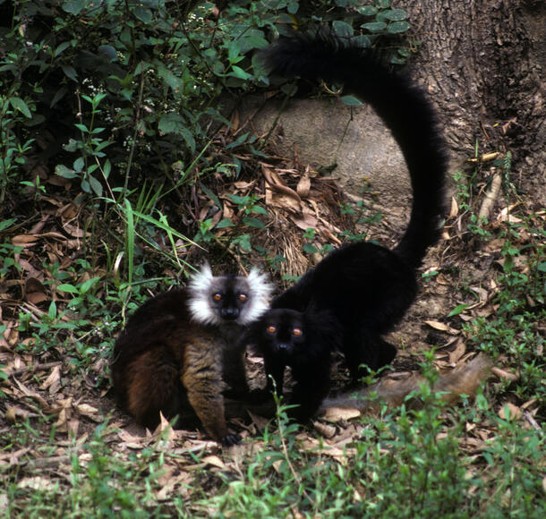
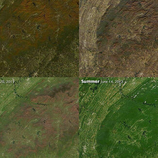
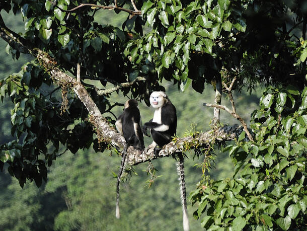
We use spatially-explicit models including ecological niche models (ENMs – also called species distribution models or SDMs) to test hypotheses about the biogeographic history of organisms, and to predict future changes in their distributions in response to environmental changes, such as climate change. Our case studies include lemurs and other mammals in Madagascar, primates and other animal and plant species in Southeast Asia, coyotes in New York City, and jaguars in South America, among others. For example, with partners at Vietnam National University, Rutgers University and Henan University, we are using ENMs to advance transboundary conservation of key endangered species in the Sino-Vietnamese border area as habitats and threats shift due to a changing climate.
Our results across multiple species highlight how many ecological, evolutionary, and anthropogenic processes are occurring simultaneously. This work takes a crucial step towards better understanding how evolutionary processes and the evolutionary ecology of species may respond to continued environmental change.
CBC staff also advance methods and build open source software tools for conservation practitioners to apply state-of-the-art modeling methods towards conservation activities.
With funding from NASA and in collaboration with the City College of New York (City University of New York), University of Connecticut, Pace University, and the Alexander von Humboldt Institute in Colombia, CBC Director for Biodiversity Informatics Research Dr. Mary Blair is leading a new project to expand the open-source species distribution modeling (SDM) software Wallace to facilitate biodiversity change indicator calculations for the Colombia Biodiversity Observation Network, and to enhance Humboldt's existing SDM web application, BioModelos.
As a part of this project, the team has developed maskRangeR, a new software that improves estimates of species’ ranges. This tool enables users to choose among a range of methods to refine the predictions from SDMs to estimate a species’ current range. The team also developed changeRangeR, a package that translates species’ current distributions into meaningful conservation metrics in repeatable and transparent ways.
In addition to offering training workshops around the world for our open source software tools, Dr. Blair teaches a course on “GIS and remote sensing for conservation and evolutionary biology” at AMNH’s Richard Gilder Graduate School. Through the course, students gain the skills to incorporate spatial modeling into their dissertation research.
CBC staff also organize the New York Regional Species Distribution Modeling (NYSDM) discussion group, which brings together leading researchers from across the New York Metro area, including research scientists from industry and conservation organizations as well as professors, graduate students, and postdoctoral scientists from CUNY, SUNY Stony Brook, NYU, Columbia, Yale, UConn, NYBG, EcoHealth Alliance, WCS, Rutgers, Harvard, and Princeton (among others), to present research and new methods related to spatial modeling for biogeography and conservation.
Additional resources:
- Maxent
- "No longer a black box: How did Maxent go open-source?", Ecography blog.
- “The challenge of modeling niches and distributions for data-poor species”, Ecography blog.
- An icon of the American Wilderness is Alive in the Bronx
- maskRangeR
- changeRangeR
- Wallace
- BioModelos
- GEO BON
Project partners:
- This work was partially supported by the U.S. National Science Foundation (NSF) and the National Aeronautics and Space Administration (NASA) GEO Work Programme.
- This work benefits from the support of the Prince Albert II of Monaco Foundation