New York State Geologic Map
Part of Hall of New York State Environment.
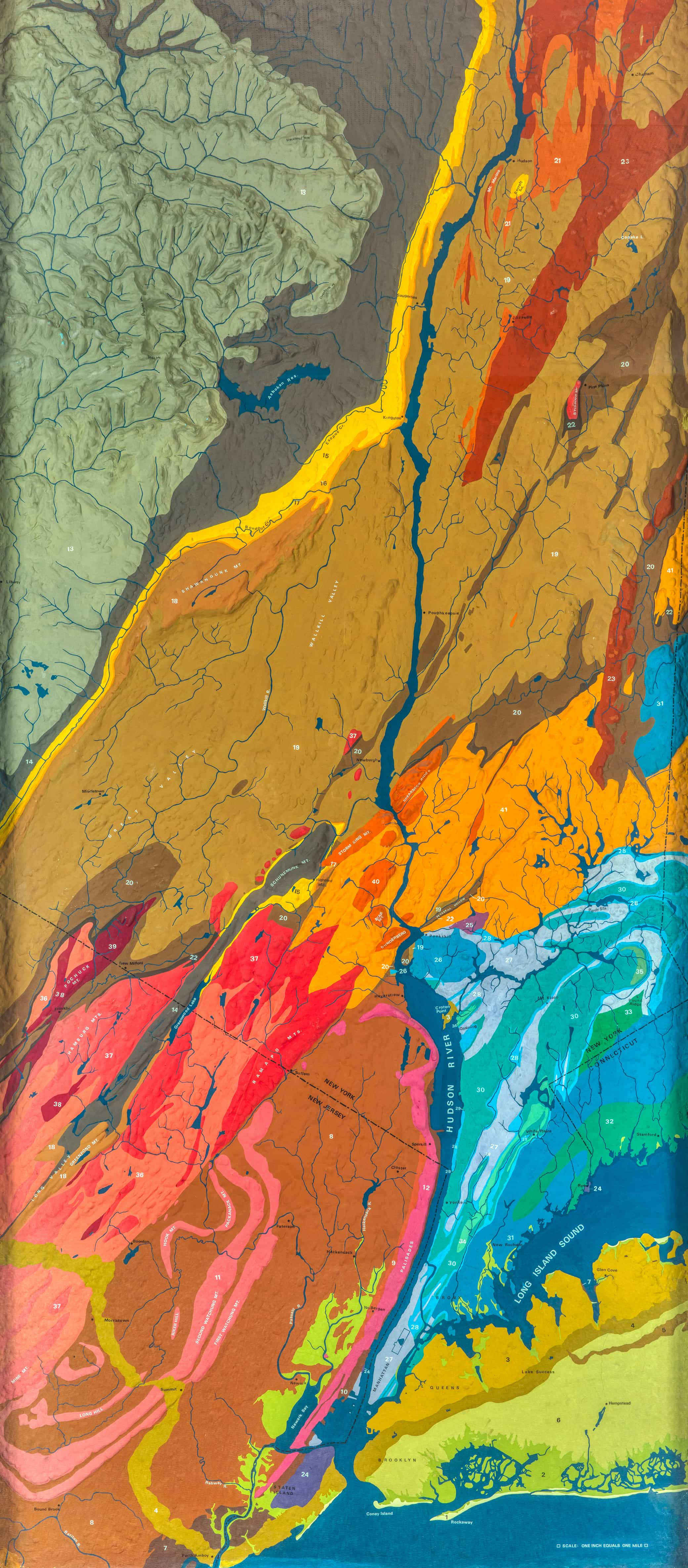
This geologic-geomorphologic map covers the region from Hudson, New York, at the top down to New York City at the bottom. In the upper left you can see the high peaks of the Catskill Mountains, where much of New York City’s drinking water comes from. The lower hills in the middle, shown in orange and red, are the Hudson Highlands. To the lower left, shown in dark brown with swirls of pink, is the remains of a rift valley where lavas flowed and dinosaurs roamed. The brownish green band wiggling across the bottom marks the southern edge of a glacier that melted away at the end of the ice age.
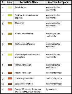
This map depicts many aspects of the lower Hudson River Valley land surface. Each color represents a different rock formation, or a rock unit that’s distinct from the rock surrounding it. The lumps and bumps of the map surface depict the elevation of the land, exaggerated a little to help us see the shape of the land.
Download the PDF below for a legend that provides information about the age, type of rock, and formation name for the rock and sediment found at different locations within the mapped area.