Space has been called the final frontier. And yet, here on Earth there is a vast unknown realm that’s ripe for discovery: the bottom of the oceans. To this day, very little of the seafloor—only about 15 percent—has been mapped with reasonable accuracy by direct measurement.
“We have more detailed maps of the surface of Mars than we do the ocean floor,” says John Sparks, curator in the Department of Ichthyology and curator of the special exhibition Unseen Oceans.
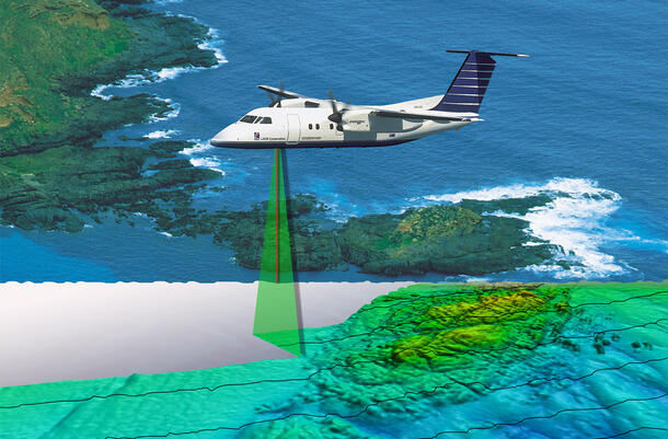
But slowly and surely, that may be changing. Bathymetry, the measure of the depth and shapes of underwater terrain, has come a long way since the days of sailors dropping weighted ropes from the side of ships. Today, radar pulses from orbiting satellites, laser beams sent by piloted planes, unmanned drones, and sonar or sound waves emitted from ships and submersibles are allowing researchers to see the seafloor clearer than ever before.
Still, despite advances in technology, levels of resolution are, well, all over the map. For the moment, the most effective tool is sonar, since sound waves travel faster and farther under water than on land. Even so, the most efficient use of sonar—called multi-beaming or “mowing the lawn”—is very slow and painstaking.
The most ambitious international effort to date—to map all 140 million square miles of seafloor by 2030—was announced in 2017, but until now mapping has largely been the result of a patchwork of efforts: commercial searches for oil and other natural resources, scientific studies, and even search and recovery, such as the 2014 investigation of missing Malaysian Airlines Flight 370.
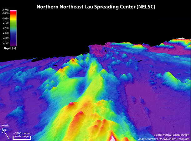
That said, there has been steady progress. In August 2015, an international expedition to the Galápagos Islands refined the resolution of deep-sea depth readings by 100 times. By simultaneously using multi-beam sonar from a ship and side-scan sonar in an autonomous underwater vehicle (AUV), researchers were able to reduce the distance between scans from over 3,000 feet to 30 feet—a huge increase in the clarity of the results.
Advances in mapping like these are helping today’s researchers learn more than ever before about the seafloor, and discover previously unknown features of Earth’s surface.
Find out more about deep-sea mapping and ocean topography when you visit the special exhibition Unseen Oceans, which is free for Members.
A version of this story originally appeared in the Spring 2018 issue of Rotunda, the Member magazine.