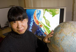
Miaki Ishii is an associate professor of Earth and Planetary Sciences at Harvard University who uses North American seismometers to understand how the magnitude 9 earthquake in Japan in March 2011 started and spread.
What geological forces caused the 2011 earthquake in Japan?
At the site of this earthquake, the Pacific plate is colliding with the North American plate—that part of Japan, believe it or not, is considered part of the North American plate. When two things bump into one another, you have stress buildup, and to relieve it, there are earthquakes. In this case, a lot of stress had accumulated for over 1,000 years, and it was released all at once in a huge quake. Many faults failing at once also made this a large event.
What was unique about this quake versus others?
It happened in a place we were expecting, but it also slipped in ways and in places we weren’t, including areas that we didn’t think were capable of generating earthquakes.
How can North American seismometers teach us more about the event in Japan?
Consider throwing a pebble into a pond. You’d see a water ripple propagating from where the rock hit the water’s surface. If I took a picture of that and asked you where the rock hit the water, in your mind, you could go back in time, collapse that ripple back to the center, and find the source of energy. We do same thing, but instead of a pebble, we have earthquakes generating the energy and seismic waves. Using seismic stations in North America as our eyes, we see the wave and collapse it back in time to find where the energy came from.
Could this event have been larger than it was?
Our study shows that if you take this view of many faults failing at once to create a large earthquake, and then you look at how many quakes failed before and after the March 2011 event, it seems like that region could have had a magnitude 9.2 instead of a 9.0 earthquake.
Are we getting closer to being able to predict when earthquakes will happen?
We can predict earthquakes in hundreds or thousands of years, but predicting with accuracy on a timescale that’s relevant to human life is extremely difficult. However, we can definitely alert people once earthquakes happen, assuming there is a good monitoring system in place. In the case of the 2011 Japan earthquake, there were about 30 seconds from the time the warning went off to when serious shaking started in Sendai, one of the closest cities to the earthquake.
How do last week’s events in Indonesia compare?
These are the strangest we’ve seen yet. The pair of earthquakes, of magnitudes 8.6 and 8.2, occurred inside a plate. Typically, large earthquakes happen where two plates collide or slide past one another or where plates are being created. We do have some earthquakes away from the plate boundary, but they have never been as large as the two from April 11. Also, the large earthquake looks extremely complicated. For example, there is a possibility that the slip on the initial fault jumped by about 90 miles to get to another fault. We are still working to decipher what happened here, and how these events might be related to the 2004 Sumatran earthquake.