Monitoring Landscapes for Conservation Planning
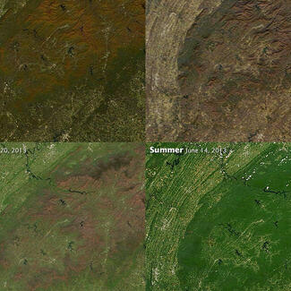
Conservation projects rely on landscape and wildlife monitoring data to plan and implement conservation and management activities. Landscape monitoring techniques are used to measure environmental conditions (such as land cover and forest biomass) to understand how an area have changed over time and to predict future changes based on past trends. This information can be used to assess the impact of conservation projects, predict change, and inform landscape management.
Developing Tools for the Conservation Community
The CBC aims to be a leader in the development and promotion of image-based landscape monitoring tools for the conservation community. We work to adapt new technology into easily accessible tools for conservation practitioners and the general public. Doing so, we function as a bridge between cutting-edge research, technological advances and practical applications that can be used to advance conservation science and practice.
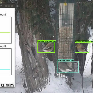
Much of our focus is on using and developing imaging systems. This ranges from satellite-based sensors to cameras mounted on poles, kite, balloons and unmanned aerial vehicles (UAVs), commonly known as drones, for getting views of landscapes that can be converted into maps.
We develop software as well as hardware for collecting and processing image data. All of our projects use, promote and contribute to the development of open source resources, and the products we create are released with open access licenses so they can be freely used.
Additional resources:
- For more information on modification of cameras visit Public Lab