6. Archaeology of the Cañada de Cuicatlán, Mexico
Authors: Jennifer Beckmann, Charles S. Spencer, Elsa M. Redmond
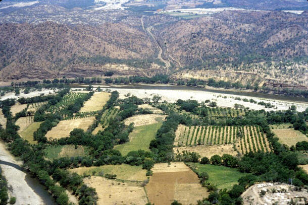
Charles Spencer and Elsa Redmond began their research in the Cañada de Cuicatlán region of Mexico in the late-1970s. The Cañada de Cuicatlán is a hot, low canyon situated between the two major south-central Mexican valleys of Tehuacán and Oaxaca.
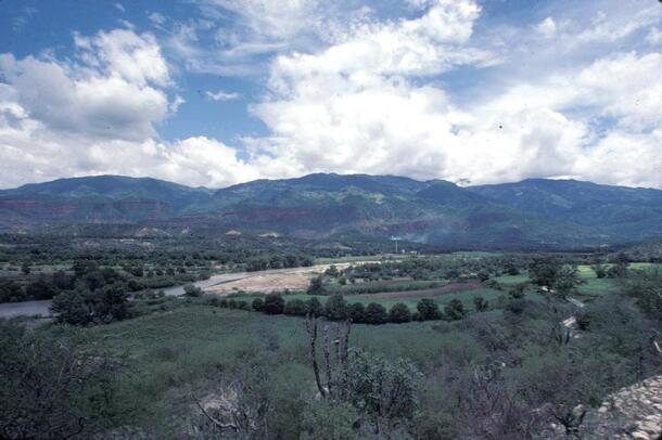
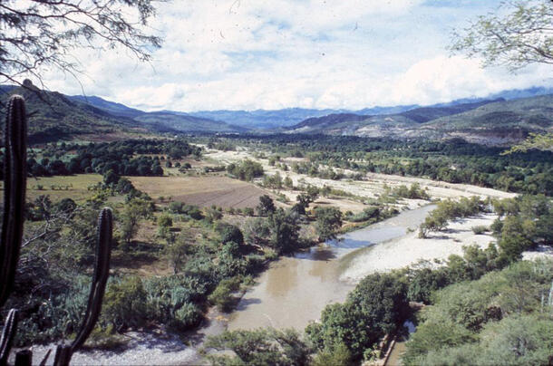
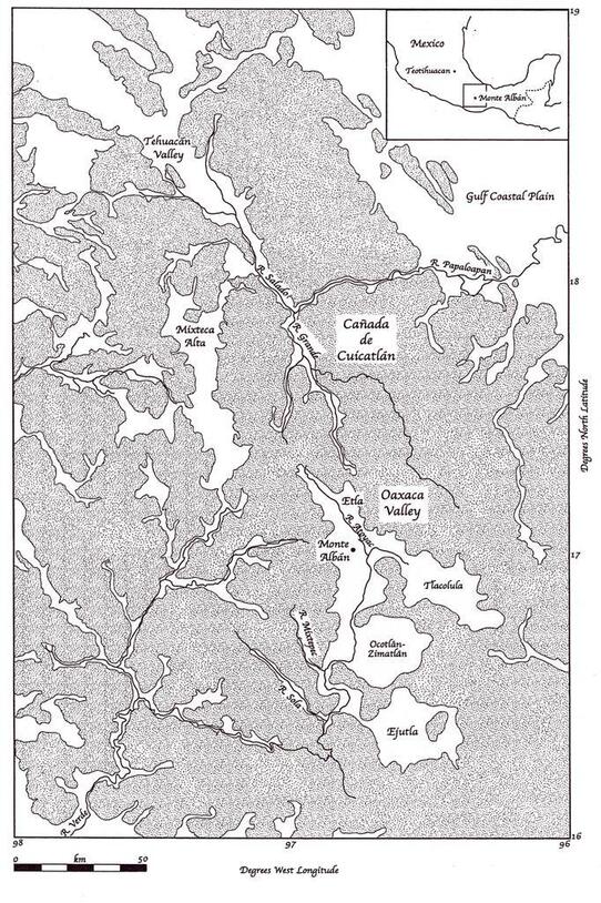
The Cañada played a vital role in transportation, exchange, and communication in this region for thousands of years, and is considered to have been the major Precolumbian route between the two valleys. Relatively little research had been done in the Cañada prior to Spencer and Redmond's survey and excavation of the region, which began in 1977. Since there had been no comprehensive excavation of the region, there was no conclusive evidence of the Zapotec invasion that supposedly took place, and the exact relationship between the Cañada and Monte Albán, the capital of the Zapotec state, remained vague. Spencer and Redmond's main goal for the Cañada Project was to clarify this relationship, shedding new light on the political and military nature of the early Zapotec state.
History and Development of the Early Zapotec State
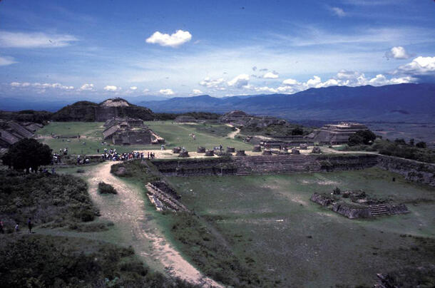
Between the Early Monte Albán I and Monte Albán II, Monte Albán grew from a simple regional center into a complex state capital. The first evidence of state organization appears in the Late Monte Albán I (300-100 B.C.) period: a hierarchical regional settlement pattern and institutional building types such as the palace and multiroom temple. The early Zapotec state continued to develop and by Monte Albán II, the capital included a gigantic Main Plaza and numerous additional public buildings with specialized functions.
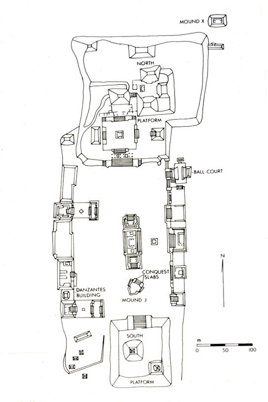
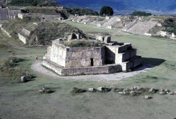
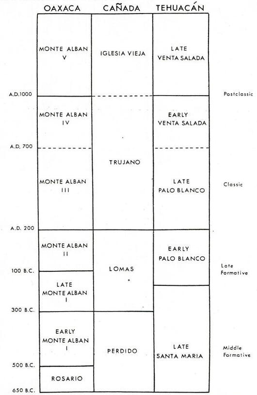
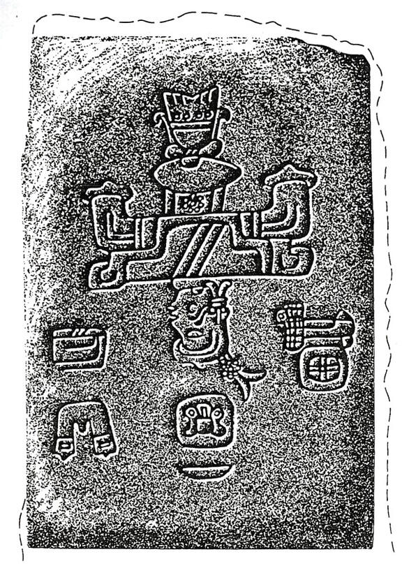
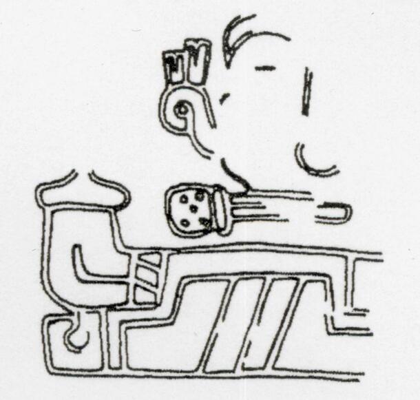
One of these buildings, the arrowhead-shaped Building J, is covered with inscribed slabs that scholars have identified as targets of Monte Albán's successful military conquests. In 1976, Joyce Marcus deciphered a number of these inscriptions, including a place sign that she proposed was referring to the Cañada de Cuicatlán. Thus the Cañada de Cuicatlán was believed to have been conquered and controlled by the early Zapotec state, centered at the city of Monte Albán, sometime between the Early Monte Albán I (500-300 B.C.) and Monte Albán II (100 B.C.-A.D. 200) periods. As shown in the chronological table, these dates correspond to the Perdido and Lomas phases in the Cañada region. As part of their research, Spencer and Redmond sought to test Marcus' hypothesized identification in their fieldwork in the Cañada, which they initiated in 1977.
Archaeological Expectations
At the outset of their project, Spencer and Redmond had a number of archaeological expectations. For example, if the Cañada de Cuicatlán had been subjugated by Monte Albán in the proposed time period, there should be evidence of an abrupt change in traditional settlement pattern and the establishment of a state-modeled regional settlement-size hierarchy. There should also be evidence of fortifications, as Monte Albán sought to protect its new territory and further expand its rule. Under Monte Albán's rule, the Cañada should have turned into a tributary province, and thus there should have been a reorganization of production and exchange activity in order to provide the state capital with the products it demanded, evidenced by fruit and seed remains from both before and after the proposed subjugation.
Archaeological Fieldwork and Results
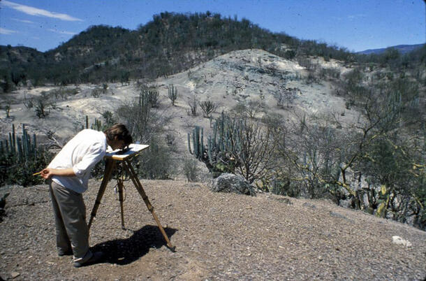
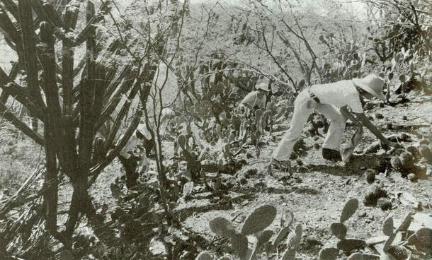
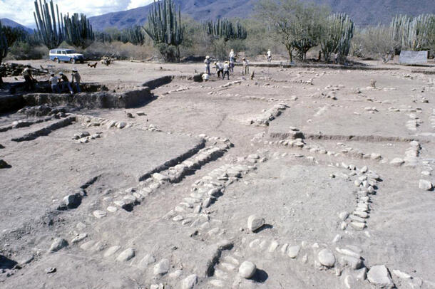
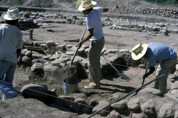
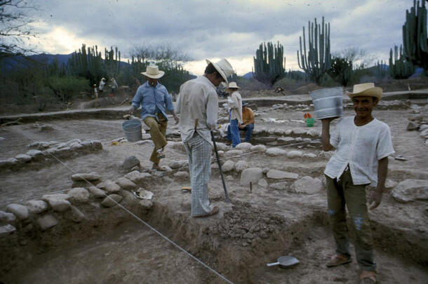
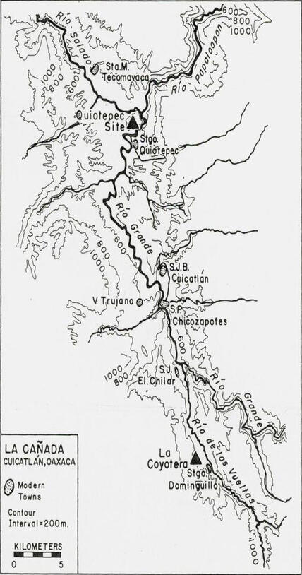
Spencer and Redmond conducted their fieldwork in a three-phase process. First, they completed a regional settlement pattern survey of the Cañada. Second, they carried out intensive mapping and controlled surface collection at the 25 formative and classic period sites identified in the survey. Finally, they conducted excavations at La Coyotera, an extensive and informative site which spanned the time period during which Monte Albán took control of the Cañada.
The results of the Cañada Project agreed with the archaeologists' expectations, supported Marcus' hypothesis, and met the main project goal. The excavated site of La Coyotera showed two clearly different settlements - Llano Perdido and Loma de la Coyotera.
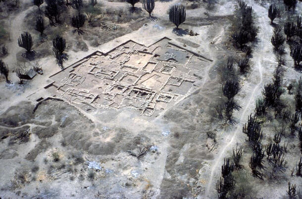
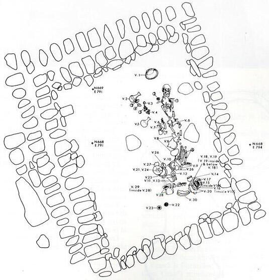
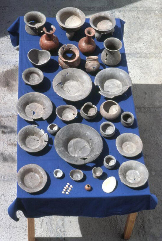
Llano Perdido was a small site located on a high alluvial terrace consisting of multifamily compounds, which were arranged around three large patios, as well as a number of burials. The site was burned to the ground between the Perdido and Lomas phases, an interface corresponding to that between Early and Late Monte Albán I, around 300 BC. Settlement then shifted to an adjacent piedmont ridge, Loma de la Coyotera. Single-family households on residential terraces, a new residential settlement pattern, were uncovered here.
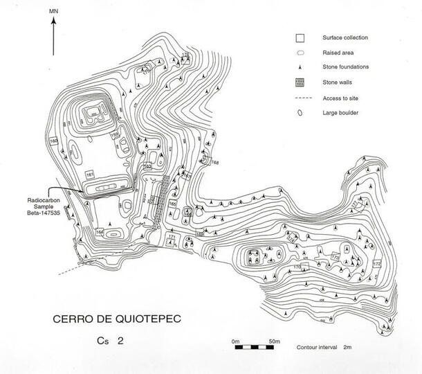
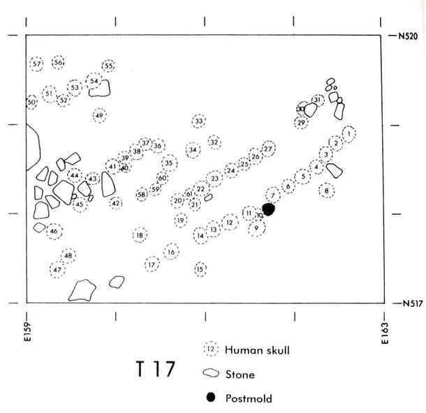
In the Quiotepec area of the Cañada, a single Perdido (650-300 B.C.) phase site was replaced by a 45ha complex of fortified occupational sites in the Lomas (300 B.C.-A.D. 200) phase. One of these sites was Cerro de Quiotepec. This complex guarded what was the only natural pass into the Cañada from the Tehuacn Valley. By fortifying this passageway, Monte Albán was able to successfully alienate the inhabitants of the Cañada from their neighbors the Tehuacn Valley, halting the cultural and economic exchange between them. There is also evidence of the increasingly tributary and subservient nature of the Cañada in the Lomas phase. There was a dramatic increase in hot country fruit and seed remains between phases, probably produced to meet tribute demands from the Oaxaca Valley, a cool valley where such plants do not grow. The subjugation of the Cañada was further emphasized by the erection of a skull rack at Loma de la Coyotera, the remains of which were uncovered by Spencer and Redmond. The Monte Albán Zapotec apparently used such gruesome symbols to emphasize their power and intimidate their subordinates.
Just as the Cañada fills the geographical gap between the Oaxaca and Tehuacn valleys, so too did Spencer and Redmond fill the scholarly gap between the two thoroughly-researched areas. With the comprehensive research and publication of the results found during Cañada Project, we now have a clear idea of the ambitious, aggressive militaristic and expansionist nature of the early Zapotec state.
Bibliography
Marcus, Joyce | |
1983 |
The Conquest Slabs of Building J, Monte Albán. In The Cloud People: Divergent Evolution of the Zapotec and Mixtec Civilizations, edited by Kent Flannery and Joyce Marcus, pp. 106-108. Academic Press, New York. |
Redmond, Elsa M. and Charles S. Spencer | |
1983 |
The Cañada de Cuicatlán and the Period II Frontier of the Zapotec State. In The Cloud People: Divergent Evolution of the Zapotec and Mixtec Civilizations, edited by Kent Flannery and Joyce Marcus, pp. 117-120. Academic Press, New York. |
1992 |
The Prehistoric City and State of Monte Albán: A View from its Frontier. In La ciudad y el campo en la historia de Mxico: memoria de la VII reunion de historiadores mexicanos y norteamericanos, Tomo I, edited by R. Snchez, E. Van young, and G. von Wobeser, pp. 3-24. Instituto de Investigationes Histricas, Universidad Nacional Autnoma de Mxico, Mxico, D.F. |
Spencer, Charles S. and Elsa M. Redmond | |
1997 |
Archaeology of the Cañada de Cuicatlán, Oaxaca. Anthropological Papers No. 80. American Museum of Natural History, New York. |
2001 |
The Chronology of Conquest: Implications of New Radiocarbon Analyses from the Cañada de Cuicatlán, Oaxaca. Latin American Antiquity 12(2):182-202. |
Additional Reading
Marcus, Joyce | |
1976 |
The Iconography of Militarism at Monte Albán and Neighboring Sites in the Valley of Oaxaca. In The Origins of Religious Art and Iconography in Preclassic Mesoamerica, edited by H.B. Nicholson, pp. 130-131. UCLA Latin American Center Publications, Los Angeles. |
1980 |
Zapotec Writing. Scientific American 242:56. |
Redmond, Elsa M. | |
1983 |
A Fuego y Sangre: Early Zapotec Imperialism in the Cañada de Cuicatlán, Oaxaca. Memoirs of the Museum of Anthropology No. 16. University of Michigan, Ann Arbor. |
Spencer, Charles S. | |
1982 |
The Cañada de Cuicatlán and Monte Albán: A Study of Primary State Formation. Academic Press, New York. |